110 p., colour photo tables, many maps and surveys; Berlin 2011. Jorg Dreybrodt & Michael Laumanns (Editors). Presents the results of the 2011 international expedition to northern Laos. 11,7 km of cave passage from 16 caves. Includes final survey of the the new longest cave of northern Laos (Tham Chom Ong System), which is also the 3rd longest cave of Laos and the currently 10th longest cave of SE Asia at 17,150 metres. Three caves of Sayabouli province exceed 1 km in length, including the underground river of Tham Nam Lot (3,560 m). In English language with a German and French abstract. Before the publication of Dreybrodt & Laumanns (2005a), which sumarises the exploration conducted between 2000 and 2005, northern Laos was virtually unknown to speleologists. Only a few reconnaissance projects were conducted prior to 2000 in the province of Luang Phrabang. The afore-mentioned publication provided information on 24.3 km of cave passages from 68 caves. In the framework of the "Northern Lao-European Cave Project" (www.laoscaveproject.de) the investigations were continued in 2006-2008 (Luang Nam Tha and Houaphan provinces) (Dreybrodt & Laumanns 2008). Further findings from 2009-2010 in the Houaphan and Oudomxay provinces were published by Dreybrodt & Laumanns (2010b). This publication reports on the findings of the year 2011 (Oudomxay and Sayabouli provinces) , including the final survey of the 17,150 m long Tham Chom Ong System (Oudomxay). The cave system is the currently 3rd longest cave of Laos as well as the 10th longest cave of Southeast Asia. This report comprises descriptions of 21 caves with 11,696 km of new passages. Overall, 92 km of cave passages from 196 caves has been surveyed and published to date from northern Laos (excluding Vang Vieng and Kasi).
More caves have been reported in the eight northern provinces of Thailand - Mae Hong Son, Chiang Mai, Lamphun, Lampang, Chiang Rai, Phayao, Nan and Phrae - than in any other region. The most extensively surveyed area is Pang Ma Pha district in Mae Hong Son province where 176 caves have been recorded. Nevertheless many caves remain to be unexplored. Thus the 100 caves selected for this book are only a small percentage of the 2,000 or so caves in Northern Thailand. They include many of the most spectacular wild caves, the famous temple caves and archaeological sites. The book covers all aspects of caves including their geology, environment, archaeology, temples and folklore as well as giving tips on their safe exploration and photography. Author Pindar Sidisunthorn, Simon Gardner & Dean Smart. 392 pages. Hardback
65 pp, maps & surveys; Berlin 2020. By Jean G. Shaw. An in-depth compilation of many unmapped caves in both the Congo Republic and Gabon. 177 caves described in detail. Has area maps with cave locations as well as geological, historical and biospeleological information. In English, with a German and French abstract.
231 pp, many annotations, maps & surveys; Berlin 2020. By Herbert Daniel Gebauer. The only comprehensive source on karst and caves of Sri Lanka. Describes over 310 cave sites, most of which are not documented according to international speleological standards. In consequence, this volume is an invaluable reference for further cave exploration in this south Asian country. In English language.
68 pp, many maps & surveys; Berlin 2021. By Michael Laumanns et al. This volume covers a gap, as there was no publication so far on the caves of Taiwan. Describes over 190 cave sites, most of which are not documented according to international speleological standards. This volume resulted from an international caving expedition to Taiwan in 2020, which mapped 2,3 km of passages from 48 caves. In English language.
Rick Stanton MBE served for years as a firefighter, but it was his “hobby” of cave-diving that was his passion He has quietly spent forty years exploring caves around the world, steadily building his unique skill set as he defied limits, pushed boundaries, and discovered parts of the earth that had never been seen before. Along the way, he and his dive partners became the ones to call for the most challenging cave rescue and recovery missions. In 2018, he found himself on the world's stage when he led the team that rescued a children’s soccer team that was trapped inside Thailand's flooded Tham Luang cave. Rick needed to rely on all the experiences and friendships he'd gathered along the way, as he carefully planned and then successfully executed one of the most noteworthy rescue missions in modern history.
This book tells the enthralling inside story of the Tham Luang cave rescue in Thailand--told by the leader of the daring underwater rescue mission.
In July 2018, twelve boys and their soccer coach disappeared into the Tham Luang Cave in Thailand.
Trapped miles beneath the surface, not even the Thai Navy SEALs had the skills to bring them to safety. With the floodwater rising rapidly, time was running out.
Any hope of survival rested on Rick Stanton, a retired British firefighter with a living room full of homemade cave-diving equipment. As unlikely as it seemed, Rick and his partner, John Volanthen, were regarded as the A-team for exactly this kind of mission.
The Thai Cave Rescue was the culmination of a lifelong obsession, requiring every ounce of skill and ingenuity accumulated by Rick over a four decade pursuit of the unknown.
While the world held its breath, Rick, John, and their assembled team raced against time in the face of near impossible odds. There was simply no precedent for what they were attempting to do. . . .
By Philippe Crochet and Annie Guiraud. This coffee table book offers a photographic journey into some of the world's most beautiful caves. The eight thematic chapters include a large number of high-quality photographs supplemented by explanatory texts in French and in English. The authors'aim is to share their passion for the underground world and pay tribute to its hidden splendors. Size : 30 cm x 30 cm (11.8 in x 11.8 in). 336 pages , weight : 4.4 lb, includes 365 color photographs. "For decades (Philippe and Annie ) have been producing world class cave images with an elegant marriage of artistic sensitivity and painstaking technique..." (Kevin Downey) "The cave photographs of Philippe Crochet and Annie Guiraud are among the best I have seen. The way they are organized and presented in these pages makes this the best cave photography book I've read." (George Veni)
43 pp, maps, photographs & surveys; Berlin 2022. Jean G. Shaw. The only complete overview on karst and caves of one of the last blank spots on the speleological world map. Describes over 40 caves and rock-shelters and many prospective sites, with references to the exploration history, archaeology, rock-art and biospeleology. In English, with a German and French abstract.
To celebrate the International Year of Caves and Karst and the great role of women in speleology. Bernard Chirol, President of the UIS Commission on History, published the book Ces Heroines des Caverns/Heroines of the Caverns - Little known history of women in the caves of the world. Speleobooks has a limited number of copies of the English language edition available. 2022. 240 pp. Paperback.
This second edition was published in May 2022, and is now available in spiral bound hard copy. 80 pp. An overview of the speleothem repair accomplished by the New Mexico-based, all-volunteer Cave Formation Repair Project from its inception in June 2018 through its third year. It also delivers step-by-step instructions for making and using the new repair tools and methods that are unique to this project. Project founder and author Mike Mansur strongly desires the techniques he and his volunteers have developed to be widely available to other cavers nationally and internationally so they might undertake formation repair work in their own local caves. In addition to informative text, each chapter features high-resolution photographs from work trips conducted by the Cave Formation Repair Project.
The author will donate $5.00, from each sale of this book to the NSS Cave Restoration Fund. The purpose of the Cave Restoration Fund is to support the repair of human-caused damage, both malicious and inadvertent. 62 pages. 2021.
The Cave Formation Repair Project: Restoring the Beauty of New Mexico’s Greatest Caves
by Michael C. Mansur (NSS #26393CL FE)
This book is designed to meet two main goals: first, to give an overview of the work accomplished by the New Mexico-based, all-volunteer Cave Formation Repair Project from its inception in June 2018 through its third year, and second, to deliver step-by-step instructions for making and using the new speleothem repair tools and methods that are unique to this project. Project founder and author Mike Mansur strongly desires the techniques he and his volunteers have developed to be widely available to other cavers nationally and internationally so they might undertake formation repair work in their own local caves.
This book is projected to be 70 pages and contains five embedded how-two videos. Each page features text blocks and captioned, high-resolution photographs from work trips conducted by the Cave Formation Repair Project.
Chapter One: How the Project Started introduces Mike Mansur, his 35-year background in cave conservation, and his impetus for initiating the Cave Formation Repair Project. Here he discusses the role federal land management agencies play in the project, the Buehler epoxy that is the central component of each repair, and his leadership philosophy about open-sourcing the knowledge gained through formation repair work to benefit caves, the caving community, and the general public.
Chapter Two: The Caves and the Formation Repairs gives an overview of the repair work conducted through the project in seven New Mexico caves. The chapter is organized by cave and displays before-and-after photos of the work accomplished at each site. Text addresses the major challenges, accomplishments, and learnings from each cave, as well as Mike’s evolution as project leader.
Chapter Three: The Tools and How to Make Them presents 10 cave-safe, PVC-based tools Mike and his volunteers have innovated to facilitate formation repairs. A list of components and step-by-step assembly instructions are given for each tool, as well as photos of each tool in use in various in-cave repair situations.
Chapter Four: New Methods and Procedures presents techniques Mike and the volunteers have pioneered that build on and expand prior approaches to effecting formation repairs. These include new ways to identify breakage and match broken pieces, improved techniques for installing reinforcement pins and stabilizing formations while epoxy cures, and camouflaging techniques for restoring the natural appearance of repaired formations.
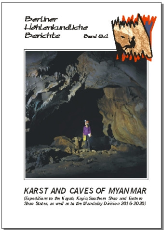
92 pp. + fold-out annexes, many cave surveys and maps; Berlin 2023. This volume provides a detailed account of the seven most recent speleological expeditions to Myanmar up till the coup d'etat in 2021, which made the country inaccessible to foreign cavers. 118 new caves are described, including Som Hein, the new longest cave of the country (at 11.8 km). The volume also includes an overview about the work on karst biodiversity and an in-depth bibliography. In English. With a German and a French abstract.
261 pp, many maps & surveys; Berlin 2022. The "Yellow Pages" on caving in the Middle East. Each country is presented in detail including topographic and karst occurrence maps as well as a description of the geological settings, the history of speleological exploration, a detailed list of the longest and deepest caves, and an in-depth bibliography. Hundreds of cave surveys and cave descriptions. Some countries also have other relevant thematic maps. In English. With German and French abstracts.
240 PP. Hard bound. A true-life scientific adventure story, this thrilling book takes the reader deep into South African caves to discover fossil remains that compel a monumental reframing of the human family tree.
In the summer of 2022, Lee Berger lost 50 pounds in order to wriggle though impossibly small openings in the Rising Star cave complex in South Africa--spaces where his team has been unearthing the remains of Homo naledi, a proto-human likely to have coexisted with Homo sapiens some 250,000 years ago.
The lead researcher on the site, still Berger had never made his way into the dark, cramped, dangerous underground spaces where many of the naledi fossils had been found. Now he was ready to do so. Once inside the cave, Berger made shocking new discoveries that expand our understanding of this early hominid--discoveries that stand to alter our fundamental understanding of what makes us human. So what does it all mean?
Join Berger on the adventure of a lifetime as he explores the Rising Star cave system and begins the complicated process of explaining these extraordinary finds--finds that force a rethinking of human evolution, and discoveries that Berger calls "the Rosetta stone of the human mind."
Paperback. Carsten Peter's adventures in volcanoes, caves, canyons, deserts, and beyond. The earth explodes in shoots of hot magma, glaciers crash into the ocean, grotesque creatures lurk in deep caves... follow noted National Geographic explorer and photographer Carsten Peter as he shows us that our precious planet Earth is one wild and extreme place!
Tornadoes, ice caves, glaciers, lightning--no territory or phenomenon is too scary for daring explorer Carsten Peter, who is right at home exploring the most outrageous places and raucous natural occurrences around the globe. Kids can follow along as he heads into extreme places and reveals the science and background behind these seemingly unexplainable natural places and phenomenon. Underlying each of his adventures is a dose of hard science, intriguing history, provocative images, tips, gear and gadget advice, and more to help kids learn about the Earth how they can help preserve the planet.
Meet the Secret Explorers - a band of brainiac kids from all around the world, here to take young readers on a series of fact-filled fictional adventures! Each with their own specialty, from outer space to dinosaurs, these young globetrotters will teach kids aged 7-9 that learning can be fun, encouraging them to become experts in something they love.
In this story, Leah the biology explorer and Cheng the geology expert are sent on a daring mission to a network of caves in India. However, when they get there they realize there's more to this mission than meets the eye. The gripping narrative is filled with scientific facts as the explorers navigate the subterranean world and come across the animals that live there.
This epic adventure is packed with:
- Fun facts and beautiful subterranean illustrations for kids aged 7-9. - Informative diagrams to make science and nature seem simple. - A summary of all the scientific discoveries made throughout the story. - Quizzes, mission notes, and a glossary of definitions making it the perfect classroom read.
Paul Saxon, a geology professor, is warned of a pending apocalypse -- political divisiveness is creating social collapse. Who will die and how will they die? Paul sees it as the Quick Death in the immediate panic, then the Big Death as supplies run out, then the Slow Death as the survivors struggle to see the next day. Paul purchases a cave property in western Alabama, outfitting the cave to be a secret, hidden refuge. Away on business in Atlanta, riots break out and Paul flees to northwestern Georgia. The rest of his family barely makes it to the safety of the Alabama cave as the President declares martial law and the southern states close their borders. Paul stumbles onto a refuge that has taken a different approach. He becomes the Discriminator, deciding who is let in and who is sent away. Hundreds of miles distant, his family is discovered and must flee. Where can safety be found, how can they get there, and will anyone help them? pb, 234 pp.
John Mylroie is Professor Emeritus of Geology at Mississippi State University. After childhood in rural upstate New York, he attended Syracuse University, graduating in 1971 with a Zoology degree Summa Cum Laude and Phi Beta Kappa, and also lettering on the soccer team. He met Joan Saxon, a fellow Zoology major and Phi Beta Kappa, in Chemistry lecture his freshman year; they were married in 1970. Draft number 69 in the first draft lottery sent John to the Navy for a year as a sonar technician. While subsequently working in the electronics laboratory of the Biology Department at SUNY Albany, John decided to turn his sporting interest in caves into a career. He entered the Geology PhD program at Rensselaer Polytechnic Institute in 1974, graduating in 1977 and taking a faculty position at Murray State University where Joan earned a MSc in microbiology and taught as an instructor.John and Joan decided to start a family in 1981, and by November 1983 had three sons, the latter two appearing as undiagnosed identical twins (surprise!). With five mouths to feed, John took the Department Head position in the Geology and Geography Department (now Geosciences) at Mississippi State University in 1985. Joan later became a Geography instructor. He continued his island cave research program, often taking the entire family into the field. The National Speleological Society awarded John their Science Award for his work on island caves in 2000, and the Honorary Member award, the society's highest award, for lifetime contributions to cave science in 2008. Joan and John have completed field work in 25 countries, and they have published hundreds of professional papers, reports, field guides, and articles. Their work on islands across the Atlantic, Pacific, and Indian Oceans, as well as the Caribbean and Mediterranean Seas, has given them insight into how peoples and cultures interact with the environment in remote settings.After a career of writing factual material in scientific literature, John decided it was time to make things up and write fiction. He has written books in the science fiction, fantasy, mystery, and spy thriller genres.
74 pp., many cave descriptions, cave surveys and maps; Berlin 2024. 12 caving days; 13 cavers; 33 caves surveyed; total score 1.8 Km; longest and deepest cave: Kijingvong Long Khun (Samomi), 335 m long and 115 m deep.
36 pp., hundreds of cave descriptions, cave surveys and maps; Berlin 2023.
The “Yellow Pages” on caving in SE Asia. Each country is presented in detail including topographic and karst occurrence maps as well as a description of the geological settings, the history of speleological exploration, a detailed list of the longest and deepest caves (incl. surveys), a list of useful addresses and an in–depth bibliography. Hundreds of cave surveys and cave descriptions. Some countries also have other relevant thematic maps. Vol. 85: Introduction & Brunei to Malaysia (168 p.). Vol. 86: Myanmar to Vietnam (167 p.). In English. German and French abstracts.
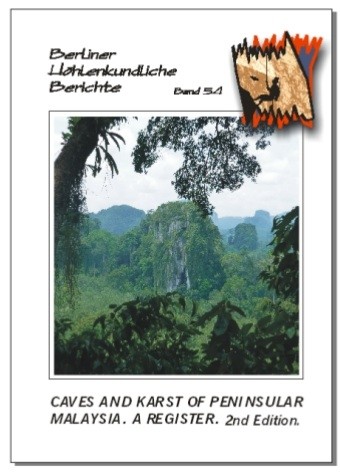
The only and most comprehensive cave registry of the mainland part of Malaysia. Lists more than 900 caves, with records starting in the 19th century. Includes geographical, geological as well as biospeleological chapters. In-depth bibliography and indexes. This is a much enhanced 2nd edition of the previous book produced in 2001 by Gua Publications (Liz Price).
The stand of play (as at March 2007) on the lava caves tube of Rwanda. Replaces volume 11 and 15 of this series. Includes the new longest cave of Rwanda (Ubuvumo Bwibihonga, at 4,530 m of length). Describes more than 72 caves with a passage length of over 25 km. Bi-lingual English/French with a German abstract.
BY Herbert Daniel Gebauer. 102 pp., colour photo tables and maps, many surveys; Berlin 2017.
Sixty-one caves are presented in this volume in detail, including Pielkhlieng Pouk which was so far surveyed to a length of 9,660 m and explored to over 12.6 km. Many of these caves are not fully explored yet. Twenty-seven caves not yet visited are mentioned, emphasizing the cave potential in the Khaddum area for future explorers. In English language.
By Dreybrodt and Loveridge. 87 pp. Over twenty-seven kilometres of caves passages from 98 new caves are described in this volume, representing the results yielded by the five most recent expeditions to the Southern Shan State (to Pinlaung, Hopong and Ywangan areas) as well as two expeditions to the Kayah State. Includes the new deepest cave of Myanmar (Ju’s Gu, over 300 m deep) as well as many new entries to the list of longest caves of the country.
83 pp., colour photo tables, many maps & surveys; Berlin 2017. Michael Laumanns & Nancy Pistole (Eds.): International Speleological Project to Cambodia 2017 (Provinces of Siem Reap, Banteay Meanchey, Odda Meanchey and Battambang). The first systematic speleological investigations in the Cambodian province of Siem Reap (Phnom Kulen National Park). New longest cave of Cambodia, La Ang Khchal (1,960 m) near the Thai border in Battambang province. Altogether 8.1 km of cave passages from 54 caves are presented in detail. In English with a German and a French abstract.
362 pages, zillions of cave descriptions, cave surveys and maps; Berlin 2017. The "Yellow Pages" of caving in Africa. New longest cave of Africa. Each country is presented in detail including maps (e.g. topography, geology and karst occurrences) as well as a description of the geological settings, the history of speleological exploration, a detailed list of the longest and deepest caves (incl. surveys), a list of useful addresses and an in-depth bibliography. Vol. 68 covers: Introduction and Algeria to Madagascar (184 p.). Vol. 69 covers: Malawi to Zimbabwe and General Ref's (178 p.). In English. With German & French abstracts in vol. 68.
70 pp., colour photo tables and maps, many surveys; Berlin 2018. The Krong No Volcanic Geopark hosts the longest lava cave of SE Asia (C7 Cave at 1,067 m) and also most of the other long pyroducts of SE Asia. This volume compiles all the caves known from the Geopark to date and describes 49 caves with a total of passages of 10.1 km. There are also biospeleological remarks, an up-to-date summary on the speleogenesis of lava caves and a chapter on the archaeology of the Krong No caves. In English, with a Vietnamese, French, and German abstract.
96 pp., colour photo tables, many maps & surveys; Berlin 2017.
This volume replaces volumes 36 and 62 of this series. About 50 caves with a total of nearly 8 km of passages are presented in detail. Includes the Mbenaltembe Cave System, at 2,380 m the currently longest cave of Gabon. Also, a presumably old rock art cave site is described. In English and French, with a German abstract.
101 pp., colour photo tables, many maps & surveys; Berlin 2017.
This volume replaces volumes 6 and 12 of this series and describes the longest caves known in Iran so far. Ghar Katalehkhor is featured with a detailed survey showing 12,860 m. The same applies to Ghar Alisadr (11,440 m) which is one of the most visited show caves in the world. A number of caves in the surroundings of Ghar Alisadr are also described. In English.
Michael Laumanns: 125 pp., colour photo tables, many maps & surveys; Berlin 2017.
This volume replaces volumes 2, 3 and 62 of this series. About 100 caves with a total of 10 km of passages are presented in detail. This is the only comprehensive source of speleological data on Mozambique. Longest cave is Codzo River Cave at 942 m. In English with a German, Portuguese and French abstract.
78 pp., colour photo tables, many maps & surveys; Berlin 2018. This volume presents a 2017 US expedition to Kampot Province in southern Cambodia as well as an international expedition in 2018, which continued the 2017 investigations in Phnum Proek District (Battambang Province). Sixty-two new caves and 9.9 km of passages were mapped, including the new third longest cave of Cambodia (Roung Heyndan 5 at 1,577 m). Roung Dei Ho-Thom Ken was extended and again became the longest of the country (2,036 m). The biospeleological findings of the 2018 expedition are also presented. In English with a German and a French abstract.
One afternoon, eleven-year-old Titan, his friends from the Wild Boars soccer team, and their coach rode their bikes to explore local caves. They crawled through the narrow tunnels in the dark to reach the center of the cave. When they turned to go home, heavy rains had flooded the tunnel. They were trapped!
With rising waters and monsoon season upon them, time and oxygen were running out. The world watched with bated breath as rescuers from around the globe joined forces to try to free the boys. After eighteen harrowing days, in an unprecedented effort of international teamwork, they were finally saved.
Award-winning author Susan Hood and journalist Pathana Sornhiran based this picture book on Sornhiran’s first-hand reporting of the event, and Dow Phumiruk’s beautiful illustrations bring the story to life. The book also includes a timeline. Ages 4-8, 48pp, HB.
The island of Palawan, in the Philippines, conceals an extraordinary subterranean treasure: the Puerto Princesa Underground River, or Natuturingan, as the locals call it. This immense cave has been a UNESCO World Heritage Site since 1999, and since 2012 it has been listed as one of the "New7Wonders of Nature".
It plays host to an underground river that traverses the mountain from one side to another, and which flows out just a few yards from the South China Sea. It features an exceptionally rich eco-system, encompassing hundreds of animal species, many of which are native, and a food chain based on the guano generated by gigantic colonies of swiftlets and bats. One of the most popular caves in the world for tourists, Natuturingan retains intact its ancient fascination thanks to far-sighted management: no lighting has been installed inside, no passageways have been paved, and no jetties have been built on the beach. Using small outriggers, visitors can sail for around one mile into the breathtaking flooded galleries. But the cave also includes numerous other chambers, some of which are colossal in scale. Here, immersed in the silence of time, there are mineral formations of quite stunning beauty.
Over the past thirty years, the La Venta group has made a crucial contribution to the efforts to explore and document this cave. La Venta's longstanding input is at last charted in this book, which gives everyone an insight into what is one of our planet's most extraordinary underground. by Antonio De Vivo, Paolo Forti (Editor), Leonardo Piccini (Editor)
98 pp, many colour photos, maps & surveys; Berlin 2020. A standard overview on the caves of one of the largest karst areas in Brazil. Includes the 2017 and 2019 international expeditions. 337 caves with a total of 22.4 km of passages are described in detail. In English, with a German and French abstract. Michael Laumanns, Rafael Camargo and Livia Madeira Cordeiro.
How did the idea of the project Lights in the Darkness came up? It all started in 2015, during a cave photographer meeting in Turkey, when Leda Zogbi gave a presentation about the Brazilian caves. Several photographers, among the most renowned in the world, were interested in coming to Brazil to meet and photograph our caves. This movement eventually generated the project called “Lights in the Darkness”. First shipment and results The first expedition took place in July 2016. 5,500 km were covered by 4 Brazilian states: São Paulo, Minas Gerais, Goiás and Bahia and the result was a beautiful 300 pgs, colorful book in four languages (Portuguese, English, French and Spanish), 8 short videos with the making-of of the expedition that can be seen on this site, and a virtual exhibition.
The book was released in July 2017 in Australia during the International Caving Congress, and later in Brazil (Sao Paulo and Belo Horizonte) and France, where the making-of videos participated in the international Spelimages contest, which selects the best Cave movies of the world. The virtual exhibition was presented in June 2018 at MM Gerdau - Museum of Mines and Metals in Belo Horizonte for 20 days, and generated a lot of interest by the museum's public.
SPAR - Expedition and Small Party Rescue Manual. 600 pages double spiral bound. More than 1000 illustrations and photographs. The skills and techniques presented in this manual have also been referred to as Small Party Self Rescue, or simply, Self Rescue. The book covers a set of assessments, skills, and techniques that a small team of cavers can use to assist an injured member of their own party without the reliance or assistance from outside resources/teams. While written in the context of caving, these skills work in other environments. They are equally useful to mountaineers, rescue personnel, fire-rescue, rope access, arborists, and military/police personnel dealing with specialized situations where minimal gear, urgency, remoteness, and sub-optimal anchor situations exist. Topics addressed in the manual include: Expedition Planning, SPAR Decision Making, SPAR Medical Considerations, Climbing Systems, Alpine SRT Haul Systems, Small Party Patient Evacuation, Water Rescue Considerations, Contingency,Anchors And More...
By Michael Laumanns & Liz Price. 335 pages, hundreds of cave descriptions, cave surveys and maps; Berlin 2016.
The "Yellow Pages" of caving in SE Asia. Each country is presented in detail including topographic and karst occurrence maps as well as a description of the geological settings, the history of speleological exploration, a detailed list of the longest and deepest caves (incl. surveys), a list of useful addresses and an in-depth bibliography. Hundreds of cave surveys and cave descriptions. Some countries also have maps showing the administrative divisions and other relevant thematic maps. Vol. 65 covers: Introduction & Brunei-Malaysia (168 p.). Vol. 66 covers: Myanmar-Vietnam (167 p.). In English. With German and French abstracts.
97 pp., colour photo tables, many maps & surveys; Berlin 2016. The first systematic speleological investigations in the Cambodian provinces of Stoeng Treng, Banteay Meanchey and Kampong Speu. Also describes 2 caves from a briefly visited new caving area in NE Battambang near the Thai border. Seventy-four new caves and one presumably old rock-art site (altogether 4.6 km of cave passages) are presented in detail. Includes an up-to-date article on cave bat conservation in Cambodia. In English with a German and a French abstract.
A limited supply of autographed copies are available.
The Xe Bang Fai River courses 6.4 kilometers through one of the world's largest and most beautiful river caves. In 2008, an international group of cavers surveyed and photographed the cave to the high standards presented in this photo-rich, full color book. Follow-up trips brought the cave's length to 16 km. Chapters by various authors highlight the history, geology, wildlife, and local culture of the cave and the Hin Nam No National Protected Area that surrounds it. Edited by David E. Bunnell and Patricia Kambesis. Copyright NSS, 2016. Hardbound,128 pages in color.
Jean G. Shaw: Caves of the Democratic Republic of Congo: exploration, science and history. - 152 pp., area maps; Berlin 2013. For the very first time this volume makes available in English language the descriptions of nearly 300 caves from the former Congo Belge - a country where the cave potential is enormous and still insufficiently known. The booklet is a standard source for cave explorers and it greatly enhances the DRC country chapter of the "Atlas of the Great Caves and the Karst of Africa", released as vol.'s 28-30 of this series.
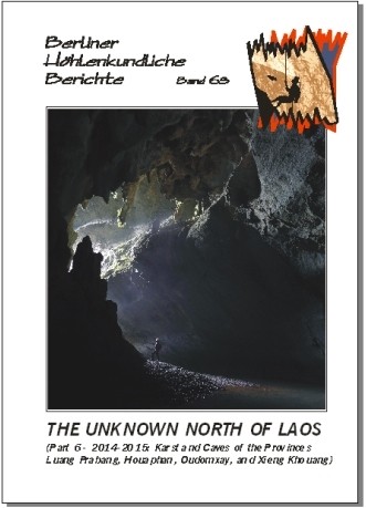
M. Laumanns (Ed.): The Unknown North of Laos. (Part 6 - 2014-2015: Karst and Caves of the Provinces Luang Prabang, Houaphan, Oudomxay and Xieng Khouang). 115 pp., colour photo tables, many maps & surveys; Berlin 2016. This volume presents the results of the 2014 and 2015 international expeditions to Northern Laos and describes a total of 23 km of passages from 70 caves. Includes the Tham Houay Ngot-Pang Ngoy System (3,620 m long) and Tham Lo (2,103 m), both in Houaphan, as well as Tham Nam Lod (1,796 m long) from Luang Prabang province. In English with German and French abstracts.
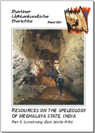
Herbert Daniel Gebauer: Resources on the Speleology of Meghalaya State, India. Part 5: Syndai, Nongtalang and Lakadong. - 122 pp., many colour maps & surveys; Berlin 2013. This volume describes the south-western corner of the Jaintia Hills in Meghalaya, NE India. Nearly 100 karst sites and caves are described in detail, the longest of which is Krem Lashing (Jaintia Hills District) at 3,086 m. Many caves still await documentation. Consequently, this is a publication for dedicated expedition cavers.
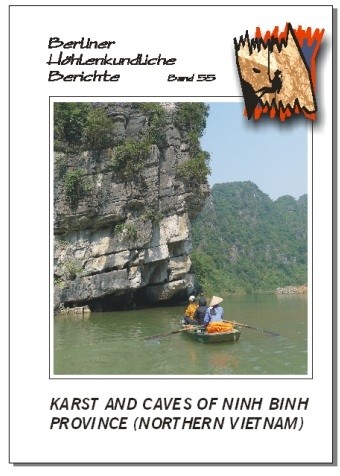
The Trang An-Tam Coc/Bich Dong landscape in Ninh Binh province has one of the most scenic tropical karst morphologies in the world and attracts up to 1 million visitors per year. The region is also famous for its cultural heritage in terms of archaeological importance and the many places of religious significance - Chua Bai Dinh being the largest pagoda in Vietnam. Hoa Lu was the capital of the Vietnamese kingdoms between the 10th and 11th centuries AD (from 968 to 1010) resulting in many historical monuments, some over 1,000 years old. There is also a high biodiversity known from the region. This unique combination makes the Trang An-Tam Coc/Bich Dong landscape one of the most stunning places to see on Earth.
The caves of Ninh Binh province are of high scientific and economic interest. Archaeological excavations have taken place in several caves in the Trang An-Tam Coc/Bich Dong area as well as in caves in the Cuc Phuong National Park, yielding Paleolithic finds up to 33,000 years old. The caves are also one of the main attractions to visitors and serve as important passageways between the intra-mountainous lakes.
This report presents the known caves of Ninh Binh province and comprises results from various explorers since 1986. Although this report mainly focuses on the Trang An-Tam Coc/Bich Dong landscape complex (Hoa Lu, Gia Vien and Nho Quan districts) it also covers caves in the Cuc Phuong National Park (if situated in Ninh Binh province) as well as caves from the Tam Diep and Yen Mo districts. Ninety-nine caves are described in detail representing a total 13.6 km of mapped cave passages.
The book in front of you can only be regarded as the very first start in regard to a complete overview of the caves of Ninh Binh province. On cave distribution maps presented in this report an abundance of cave entrances are marked with many of those caves not having been visited yet. Furthermore the karst mountains which are more difficult to access have not all been checked at all for their cave potential yet. Consequently, this publication strives to encourage more speleologists and karst. In English.
Francois Brouquisse, Louis Deharveng & Michael Laumanns. 208 pp., colour photo tables, numerous area maps and cave surveys; Berlin 2015.
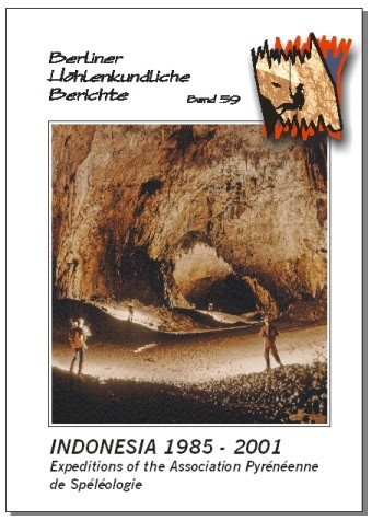
Expedition-style speleological exploration of Indonesia was started on Sumatra in 1977 by a Spanish team from the GESM Barcelona, when they visited western Sumatra. However, most knowledge on the karst of Indonesia was gathered by the French "Association Pyreneenne de Speleologie (APS)", who started exploration in the Maros karst of Sulawesi in 1985 and returned to Indonesia on an almost annual basis until 2001 and visited many karst areas all over the archipelago, often together with Indonesian speleologists. They released excellent reports with many detailed cave surveys and in-depth biospeleological data, all of which are presented in this publication for the first time in English language. Extensive karstological data (morphology, hydrology, water chemistry, climatology...) were also gathered during those 15 years. These scientific results were included in the APS caving reports as well as in specialized publications. The longest caves known in Indonesia is Luwang Jaran (Java, Gunung Sewu) at 18,200 m. Many of the other long Indonesian caves were explored by APS, such as Gua Salukkan Kallang (Sulawesi Selatan, Maros, Kappang) at 12,263 m, Leang Assuloang at 10,400 m (Sulawesi Selatan, Maros, Pangkadjene), Gua Tanette (Sulawesi Selatan, Maros, Kappang) at 9,692 m, and Gua Batu Lubang (Halmahera) at 8,685 m. Also many of the deepest caves known in Indonesia were surveyed by APS. In English.
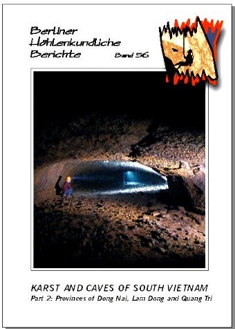
49 pp., colour photo tables, area maps and many surveys; Berlin 2014 The famous volcanic caves of Dong Nai province are presented in this volume in detail, including the new longest lava tube cave known in Southeast Asia. The 35 caves described have high biospeleological relevance. Furthermore five caves formed in granite boulder from the neighbouring Lam Dong province are included as well as a short note on caves in Quang Tri province. In English.
Herbert Daniel Gebauer. 300 pp., colour photo tables, colour area maps and many surveys; Berlin 2015
An enormous collection of cave descriptions, cave surveys, location maps and references on this major caving area in Meghalya. Descibes 222 underground sites, including Krem Kosati (18,871 m), Synrang Pamiang (14,113 m), and Krem Umsynrang (5,573 m). Also features the first image ever published from the Cloud of the Abodes!! In English.
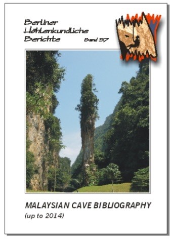
267 pp., colour photo tables; Berlin 2015. Edited by Liz Price. This bibliography covers the whole of Malaysia, i.e. Peninsula, Sabah and Sarawak, and contains almost 5,200 entries on Malaysian caves and karst, dating from the 1700s to 2014. In addition there is an extensive newspaper biblio covering 1953-2014. Other pages provide an introduction to Malaysian caves and history, and there is a map and glossary. An invaluable reference work for anyone interested in limestone caves and karst, archaeology, conservation, flora and fauna, geomorphology, geology, hydrology, history etc., as well as for the sporting caver who wants to learn more about Malaysian caves. In English.
112 pp.; Rafael Camargo, Joel Despain & Michael Laumanns. Berlin 2016. Mindanao (Sultanat Kudarat) and Luzon (Kalinga and Cagayan-Sta. Teresita). Presents the results yielded by two expeditions who targeted previously untouched caving areas in the Philippines: the mountainous karsts of Sultanat Kudarat and Kalinga provinces as well as the coastal cone karst of Sta. Teresita. Sixty-nine caves with a total of about 12.5 km of passages are described in detail. Includes area maps and an in-depth chapter on the biospeleology of Luzon Island. In English.
Alexey Zhalov (editor). 105 pp., numerous colour maps, cave surveys and photo tables; Berlin 2015 Beside scientific studies on the geosettings, tectonics, cave climatology, and biospeleology as well as an overview about the history of cave exploration in Albania this volume presents the 52 most important caves of the Albanian Alps. This includes the four deepest caves currently known in the country: Shpella BB-30 (-610 m), Shpella Ru (-580 m), Shpella e Celikokave (-505 m), and Maya Arapit Cave at 431 m (+363/-50 m). The volume also has extensive cave lists and an in-depth bibliography. In English.
NFS replaced by volumes 65 & 66. . 338 pages, hundreds of cave descriptions, cave surveys and maps; Berlin 2010. Michael Laumanns & Liz Price (Editors). The "Yellow Pages" of caving in SE Asia. Each country is presented in detail including topographic and karst occurrence maps as well as a description of the geological settings, the history of speleological exploration, a detailed list of the longest and deepest caves (incl. surveys), a list of useful addresses and an in-depth bibliography. Some countries also have maps showing the administrative divisions and other relevant thematic maps.Vol. 40 covers: Introduction & Brunei -- Malaysia (172 p.).Vol. 41 covers: Myanmar - Vietnam (166 p.).In English language. With a German and French abstract. In 2002 the "Atlas of the Great Caves and the Karst of Africa" was released in this series (Laumanns 2002a, b, c). It had two updates (Laumanns 2005, 2007) before a second edition of the atlas was finally released (Laumanns 2008a, b, c). This publication became a standard reference work and an idea was born to use the same concept for compilations on other regions of the world. This resulted in the atlas currently in front of you, representing a region which contains some of the most varied and spectacular karst morphologies in the world. In April 2009 the world's 'biggest/longest' passage was found in Hang Son Doong in Vietnam (Phong Nha-Ke Bang National Park, Quang Binh Province). Sarawak Chauber in Lubang Nasib Bagus (Malaysia) is the world's largest underground chauber. Clearwater Cave (Sarawak, Malaysia) at 175 km is the longest in Southeast Asia, and currently 10th longest in the world. The "Atlas of the Great Caves and the Karst of Southeast Asia", is based on the "Atlas of the Great Caves of the World" (Courbon et al. 1989), on the "Atlas des cavites non calcaires du monde" (Chubert & Courbon 1997), as well as on the "Encyclopaedia Biospeologica" (volume III) (Juberthie & Decu 2001) and on the "Encyclopaedia of Caves and Karst Science" (Gunn 2004). The "Speleological Abstracts", published annually by the UIS, served as source for publications after 1980. Furthermore, valuable information on the latest French speleological campaigns in Southeast Asian countries was taken from the annual reports of the "Commission des relations et expeditions internationales" (CREI) published by the Federation Francaise de Speleologie. In case experts on a specific country will detect inconsistencies or faults in a specific country chapter they are hearty invited to contact the authors and provide amendments. Substantial contributions will be rewarded with a courtesy copy of the next update of this atlas. In the reference lists the articles that have been seen by the authors are printed in italic letters. All north direction arrows on the cave maps refer to magnetic north. Inquire for individual volumes.
82 pp, photo tables and many surveys, 3 annexes; Berlin 2002. M. Denneborg, M. Laumanns, M. Schnadwinkel & St. Voigt. Report on the first caving expedition ever to Cambodia -- and the only one, which has been conducted up till now. Detailled description of the caves in the Kampot district (southern Cambodia). 11,5 km of mapped passages in 37 caves. In English language with a French abstract. Between 27th of Deceuber 1995 and 2nd of February 1996, a German-Cambodian exploration project on Cambodian caves and karst phenomena took place in the south of Cambodia. It was the first speleological project at all that has been carried out in this country. The German project participants were Michael Denneborg, Bjorn Grun, Herbert Daniel Gebauer, Michael Laumanns, Matthias Schnadwinkel und Stefan Voigt. During the campaign 11,5 km of caves were explored and surveyed and three ancient cave Shiva temples from the 6th century (Funan period) were discovered. This successful outcome was the result of great the personal support from the minister of culture Mr. Nouth Narang and the effective organisation by his personal secretaries Mr. Khuon Chamroen and Mr. Ek Buthan who accompanied the campaign the whole time. We are also acknowledging the brilliant technical support from the German ambassador Dr. W. Treskow and his staff. The fundamental basis for the success of the campaign was the generous financial funding by the German Ministry of Foreign Affairs. The speleological campaign had four aims: * Exploration and survey of the Cambodian caves * Documentation of archaeological objects * Recommendation for the use of the caves for touristic purposes * Training of local staff The results can be summarised as follows: During the campaign 37 caves with a total length of 11.5 km were surveyed. The caves are located in the Province of Kampot. The longest Cambodian cave is Roung Dai Ho near Kampot at 1.8 km of length. The main karst areas of Cambodia near Battambang and Stoung Treng could not be visited for safety reasons. We recommend another campaign in this area when access is possible. In three caves Roung Vihear Tuk, Roung Vihear Preah, Roung Prasat ancient Shiva temples and artefacts from the 6th century AD were found, which show evidence of unexpectedly strong influence by Indian culture in this area. We are sure that further scientific research will provide new knowledge about this period of Cambodian history. For three caves we consider a good potential as tourist show caves. Necessary for an inevitable long-term benefit is the careful conversion to a tourist cave and the appropriate training of tourist guides. One cave is the Roung Dai Ho together with nearby Roung Nakta. The caves are situated near the town of Kampot close to a road. An interesting round trip can be arranged easily in the Dai Ho cave. Another cave is Roung Bat Khteas together with Vihear Tuk. Roung Bat Khteas has some impressive galleries and flowstone passages. Furthermore, one of the three ancient temples discovered is located in the nearby Vihear Tuk and the surrounding countryside is very scenic. The road to the caves has to be improved. The cave Roung Preah Nipean near Kampong Trach with a modern temple and Buddha statues gives the opportunity to develop a show cave with very little effort in a scenic countryside. During the whole campaign Mr. Khuon Chamroen and Mr. Ek Bhutan accompanied us. They were introduced to the basic principles and technique of cave exploration and documentation. For a further development of the tourist potential of the caves we highly recommend future instruction in Germany. Part of this instruction should be: principles and basic technique of setting up a show cave such as construction of paths and stairs/ladders according to appropriate safety standards, enlargement of passages, illumination, advertisement, training of guides, nature and cave protection. A participant of the campaign in Cambodia, Stefan Voigt, is member of the society "Kluterthohle e.V." so that a great part of the training could take place under his supervision (the Kluterthohle is a large show cave in Ennepetal/Germany which is also used as an underground sanatory). The training program should include the visit of show caves in Belgium and France and information about their development.
67 pages, maps & surveys; Berlin 2005. Herbert Daniel Gebauer. The whole Northwest of India is dealt with in this volume. 129 caves, some man-made caverns and wells are described in detail. Many cave surveys. 15 pages of bibliographical references, a glossary and about 170 footnotes. In English language. Special Order.
4-6 week delivery time. 212 pages, numerous maps & surveys; Berlin 2007. J. Masschelein; V. Coessens; D. Lagrou; M. Dusar & Tran Tan Van (eds.). Nothing less than over 92 km of passages from 270 caves. Including the deepest cave of northern Vietnam (Cong Nuoc, -600 m). A standard reference work on karst and caves of northern Vietnam. In English language, with a German, French, Flemish and Vietnamese abstract. This report has been compiled from the results of eight Belgian-Vietnamese speleological expeditions to the NW of Vietnam between 1993 and 2006. Karst and caves of five provinces were studied with the provinces of Son La and Lai Chau having been subject of the most detailed investigations, which have led to a long-term development project in both provinces. During the expeditions 270 caves were explored. In total over 92 km of cave passages were surveyed. Amongst them is Cong Nuoc Cave in the Tam Duong area at a depth of -600 m, currently the deepest cave on the mainland of Southeast Asia. The longest cave surveyed so far is the 2,920 m long Noong Khat. 24 caves at a length of over 1 km were found. 265 caves were mapped in the provinces described in this publication. Two other caves were also added to the list of investigated caves: Xa Xa Pin 2 in the Dong Van area, surveyed by a previous Italian expedition, as well as Cau Cuoi in the Yen Bai province. On the way between Son La and Hanoi two more caves (Co Du and Hang Nghiem) were explored in the Moc Chau area in 1997. In 2001 a further cave (Nam Phe 1) was surveyed in the Nam Phe area of the Tam Duong region, which is located north of the areas that were studied in the Lai Chau province. This brings the total of described caves to the nuuber of 270.
143 pp, colour photo tables, numerous maps and surveys; Berlin 2008. Joerg Dreybrodt & Michael Laumanns (Ed.) Presents the results of the 2006 - 2008 international expeditions to northern Laos. Over 27 km of cave passage from 59 caves. Includes a study on the water chemistry of the caves in the Virngxai area as well as a detailed biospeleological overview on whole Laos. In English language with a German and French abstract. Before the publication of Dreybrodt & Laumanns (2005), which summarises the exploration done between 2000 and 2005, northern Laos was virtually unknown to spelaology. Only a few reconnaissance projects were conducted prior to 2000 in the province of Luang Phrabang. The afore-mentioned publication provided information on 24.3 km of cave passages from 68 caves. In the framework of the "Northern Lao-European Cave Project" (www.laoscaveproject.de) the investigations were continued in 2006 (Louang Nam Tha province, Vieng Phouka), 2007 and 2008 (mainly Houaphan province, Vieng Xai). In the Houaphan province (Vieng Xai) the communist Pathet Lao had its headquarters for 9 years during the Vietnam War. Extensive military and logistical use of caves was made in this heavily bombed region, including underground cave bunkers for the communist party leaders and subterranean hospitals. These historical cave sites are maintained as national monuments and symbolize the birthplace and rise of the communist party of Laos. The caves attract a growing nuuber of foreign visitors. Underground river courses with huge and beautifully decorated cave passages are abundant and many of them are through caves including the 4.5 km long Tham Nam Long as well as the 3 km long Tham Nam. Nine other caves were explored in 2007 yielding a total of well over 10 km of mapped passages. During the 2008 speleological project 6.7 km of passage from 22 caves were added in the same area, including Tham Ma Liong at 1,565 m of length. The 2008 project was subject of a professional film documentary by ARTE TV channel. Another caving area north of Vieng Thong was briefly visited in the Houaphan province. This region belongs to the Nam Et Phou Louey National Park from where several caves were described by environmental projects with emphasis on eco-tourism. Three days yielded over 2 km of passage from three caves, including the unfinished Tham Thia Thong where about 200 m of passage needs to be added to the already surveyed 1.2 km. Many more caves await exploration. The remaining three of the 15 cave kilometres mapped during the 2007 project came from other regions, mainly from the Phou Khoun area (Luang Phrabang/Vientiane province) where the 2 km long Tham Deu-Tham Dout system consists of two unconnected river caves. Overall, 51.3 km of cave passage from 136 caves has been surveyed to date in northern Laos. This publication reports on the findings of the years 2006- 2008.
130 pp., colour maps, many surveys; Berlin 2010. Michael Laumanns (Editor). Everything on the caves and the karst of Burma. Descriptions of over 280 underground sites, including man-made underground temples. ALL available cave surveys, many of which are published for the first time. Has location maps, an in-depth bibliography as well as a synoptic list of caves according to provinces. The compilation also has chapters on cave archaeology, and biospeleology, including cave-dwelling bats. In English language with a German and French abstract. Myanmar is still one of the "blank spots" on the speleological world map. The difficult political situation in the country and the restricted access to areas along its borders to Thailand, Laos and India have made only a few speleological expeditions possible so far. However, over the years several investigative projects were carried out with their results scattered in several publications. Especially in most recent times several expeditions were held. This volume aims to give a complete overview about the stand of speleological exploration of Myanmar. The results of all previous cave projects are presented to provide a solid basis for planning future explorations. This compilation also strives to align erroneous locations, name transcription problems as well as double denominations assigned to the same caves -- all of which occurred in the literature. Furthermore a biospeleological overview is presented, including the bats of Myanmar.
107 p., colour maps, photos, tables, and many surveys; Berlin 2011. Michael Laumanns (Editor). This volume presents the 2010 and 2011 German-British cave projects expedition to South Vietnam and mainly covers the karst of Ha Tien-Hon Chong as well as the Marble Mts. south of Da Nang. This volume describes a total of 4,318 m of underground passages from over 60 caves in detail, the longest of which is Hang Moi Chau (1,003 m long), together with an in-depth chapter of the biospeleology of South Vietnam. In English with abstracts in German, French and Vietnamese. Spectacular karst and large caves are known from central and northern Vietnam, e.g. in the Phong Nha/Ke Bang area (Laumanns 2010b). However, the small caving areas of southern Vietnam, developed not only in carbonate karst but also in volcanic and granite rocks, have not attracted many speleologists up to now. Apart from biospeleological and a few touristic activities (Addis 1970, Deharveng et al. 1995, Price 1995) the rich diversity of caves in south Vietnam (Ha Tien/Hon Chong area in Kien Giang province) was first investigated systematically by a German-British team in 2010, followed by a 2011 lightweight German-British expedition to Kien Giang and Da Nang provinces. This has resulted in the present publication, which describes more than 60 caves with a total of 4,318 metres of surveyed underground passages. This publication strives to encourage other speleologists to continue with cave exploration in south Vietnam as this compilation is regarded as being far from complete with regard to the karst and caves of south Vietnam.
Read about the thrilling adventures of international expeditions to this wild region in "Beneath the Cloud Forests - A History of Cave Exploration in Papua New Guinea". This compelling narrative by Howard Beck was honored by the International Union of Speleology with an award in 2005. An account of adventure and exploration in one of the world's last remaining wild places: the primordial jungles of Papua New Guinea and the strange realm of the caverns that lay hidden beneath them. Since 1965, over 30 international caving expeditions have been fielded throughout New Guinea. The story unfolds like a drama, a compelling narrative of survival both above and below ground. By Howard Beck. 2003, Speleo Projects, hardbound. English, with numerous illustrations. 352 Pages, 64 color, with 31 maps.
J. Dreybrodt & M. Laumanns (Eds.): The Unknown North of Laos. (Part 5 - 2012-2013: Karst and Caves of the Provinces Luang Nam Tha, Luang Prabang and Houaphan). - 150 pp., colour photo tables, many maps & surveys; Berlin 2013. This volume presents the results of the 2012 and 2013 International Expeditions to Northern Laos and describes a total of 27 km of passages from 95 caves, all of which are represented by a detailed survey. Includes Tham Doun Mai (3,745 m) and Tham Nam Oogh (3,140 m). In English with German and French abstracts.
S. F. M. Breitenbach & H. D. Gebauer: 199 pp., colour photo tables and maps, many surveys; Berlin 2013. This is our first anniversary volume! It has in-depth descriptions of over 350 cave/karst sites and also includes the historical surveys of the British expeditions in the 1940ties led by E.A.Glennie. Too many caves are unmapped yet. Consequently, this publication is a unique source for future explorers striving for improvements. In English language.
J. Dreybrodt & M. Laumanns (Eds.): 94 pp., colour photo tables, many maps & surveys; Berlin 2013. The follow-up volume of no. 39 in this series. Presents the results of 5 expeditions of the "Myanmar Cave Documentation Project" and describes 98 new cave/karst sites with a total of 17 km of new passages, exclusively from the Shan States. Includes the new longest cave of Myanmar (Kyauk Khaung at 4,790 m) as well as the new deepest cave (Mai Lone Kho at -160 m). In English with German and French abstracts.
1995 by Anne and Vernon Atkinson. With a supplement on Hawaiian Volcanoes which illustrate some of the features from Undara. Many photos and illustrations.
By Max Wisshak and Stefanie Tisshak. New Zealand Karst is a high-quality coffee-table book put together in close collaboration between Max and his wife Stefanie. The book is aimed equally at a readership interested in natural science and at friends of skilful nature photography. Accompanied by a foreword contributed by renowned karst researcher Paul W. Williams, the lavishly designed 256-page work guides you through the diverse aspects of New Zealand karst landscapes and caves.
This book takes you on a visual journey across sublime karst scenery and into the subterranean wilderness of New Zealand caves. Accompanied by popular scientific texts, stunning images lead you from the sculptured limestone pavements of the alpine marble karst to the grassland and jungle karst of the foothills, onwards into the twilight zone and deeper into the caves. It explores the diversity of peculiar features and creatures of the underground, ventures back into the light of cave ruins, and concludes with karst-related Maori rock art.
Learn about the life cycle of the endemic glowworm and the critically endangered Nelson cave spider. Explore the majesty of cave minerals forming speleothems of all types. Discover the many roles water plays in shaping karst and understand the vulnerability of these geotopes and biotopes. New Zealand Karst reveals how you can appreciate karst as a phenomenon where geological, biological, and archaeological beauty all come together in harmony.
In addition to the standard edition, this coffee-table book is also available as a limited special edition in a solid and elegant slipcase.
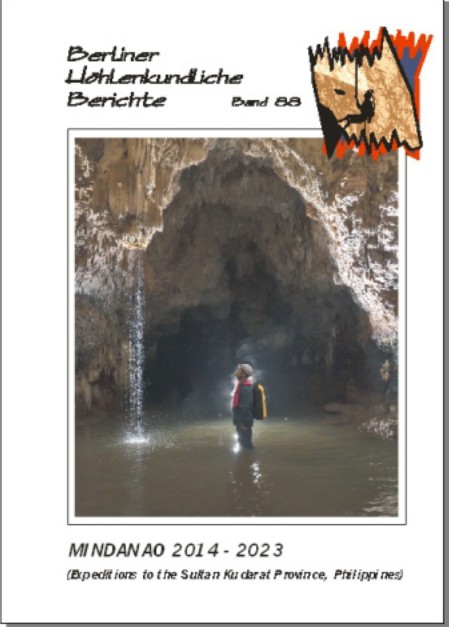
Nancy Pistole (Editor). 82 pp., many cave descriptions, cave surveys and maps; Berlin 2024. This volume summarizes the 2014-2023 expeditions of Philippine and US cavers to the Kulaman Plateau in Sultan Kudarat Povince, SW Mindanao). Thirty km of passages in 150 caves were documented, 56 cave maps were finished so far and are included in this volume.
This bibliography covers the whole of Malaysia, i.e. Peninsula, Sabah and Sarawak, and contains almost 6200 entries on Malaysian caves and karst, dating from the 1700s to 2023. In addition there is an extensive newspaper biblio covering 1953–2023. Other pages provide an introduction to Malaysian caves and history, and there is a map and glossary. An invaluable reference work for anyone interested in limestone caves and karst, archaeology, conservation, flora and fauna, geomorphology, geology, hydrology, history etc., as well as for the sporting caver who wants to learn more about Malaysian caves.
Author Martin Broen, Foreword by Alex Mustard, Introduction by Paul Nicklen
Ten Best Photography Books of 2024, Smithsonian Magazine
An immersive journey into a natural wonder--the underwater caves and cenotes of Mexico's Yucatan Peninsula, a destination very few divers have ever reached.
Shining a light into the "Underworld" (Xibalba, as the Maya called this sacred place), these stunning images from cave diver and award-winning photographer Martin Broen transport us into a secret and fascinating world accessed from cenotes, water-filled gateways to an infinite labyrinth of tunnels that create the longest underwater cave systems on the planet.
Over multiple expeditions and utilizing groundbreaking diving and photographic techniques, Broen has captured more than 250 different cenotes, their caves, and the dramatic secrets that lie within them, bringing photographs from his explorations back to the surface. Paired with images of startling otherworldly beauty, Broen's engaging text guides readers through the unique features of the Yucatan cenotes: from dramatic sinkhole entrances to decorated underwater caverns filled with rainbow colors; from ancient time capsules that document the fossil record to the critical environmental role that cenotes play today.
With contributions from Alex Mustard and Paul Nicklen based on their own diving experiences, this volume beckons divers, cavers and armchair explorers into a uniquely dangerous yet beautiful and essential underwater world.
89 pages, many cave maps and photos; Berlin 2026. Peter De Geest, Michal Hejna & Jos Beyens. This is an update to Volume 20 in this series, which described 28 caves with 22.7 km of passages. The present volume includes Belgian and Czech expeditions that have explored nearly 39 km of passages in 90 caves to date--including Giniba Cave, 13.5 km long, and Difshelei, 282 m deep. It features numerous cave maps and chapters on biospeleology, archaeology, and paleoclimate research. The text is in English with summaries in French, Arabic, Czech, and Flemish.