75 pages, many surveys and maps; Berlin 2008. Michael Laumanns; Akko Rasch & Philippe Audra. The complete overview about karst and caves of Iraq, including the results of a 2007 Kurdish-German cave project yielding the new longest cave of Iraq (Kuna Kamtiar, 5,060 m). With a detailled description of the hypogenic sulphidic spelaogenesis. In English language, with a French, German, Kurdish and Arabic abstract. Not too many cavers will seriously think about going to Iraq at the moment. However, there is a different part of Iraq existing where terrorists and kidnappings are unknown and where people are very hospitable to foreigners: the autonomous region of Kurdistan in the northeast of Iraq. The famous Shanidar Cave from where Neanderthal burials are known is located here. Due to favourable circumstances a Kurdish-German cave surveying project became reality in Octuber/November 2007. This was carried out at the invitation of the Kurdish Minister of Tourism and had brilliant logistical support by the Museum of Antiquities in Sulaimania. Within 3 weeks 21 caves with a total passage length of 8,115 metres were mapped, firmly establishing Kuna Kamtiar as the longest cave of Iraq currently 5,060 m in length. The cave is a complicated network of fossil rift passages created by sulphuruc acid water. Another highlight was Tirshawaka, a limestone cave with a sulphuruc spring inside. The sulphuruc acid has dissolved the carbonate rock and has produced a crust of replacement gypsum that covers the cave's roof and walls. The source of the sulphur is supposed to be an underground hydrocarbon deposit. Exploration of Tirshawaka was stopped in wide open river passage due to lack of time. In order to allow a better understanding of the very special mechanisms of sulphuruc cave development the present report also contains a general contribution of hypogenic sulphidic cave spelaogenesis by Philippe Audra (University of Nice, France). The cave potential in northeast Iraq remains very high and the local authorities are keen to conduct further investigations. This report also provides a general overview about the caves outside the Kurdish regions of Iraq.
By Ezzatollah Raeisi; Sharareh Ghazy & Michael Laumanns: 315 pp., many surveys and colour maps; Berlin 2012. This is by far the most extensive reference on karst and caves of Iran. Introduction: Geological and tectonic settings, state of speleology in Iran, general explanations. Many cave surveys. Rankings according to length and depth. Geological map.
The main section of the book lists and describes, in the form of a table with over 2,000 lines, all caves, which became known up till now in Iran — obtained to a great part by the translation of Persian sources, which are inaccessible in the Occident. Has even more caves as all existing Iranian cave registries. Detailed list of references. In English language, with abstracts in Farsi and German.
Vol. 45 covers: introduction & cave registry according to names (184 p.).
Vol. 46 covers: cave registry according to provinces, rankings, references, surveys, geological map of Iran (131 p.).
The 3rd edition of the Iran Cave Directory is based on volumes 10 and 37 of this publication series, which were released in the years 2003 and 2009 and described more than 850 cave locations. This edition increases the number of described caves to over 2,000. As a result, the number of caves by far exceeds all previously compiled Iranian cave lists, apparently even those available in Iran itself. Although due to the political circumstances the possibilities for foreigners to conduct karst research in Iran are somewhat limited a number of explorative projects have taken place since 2009. In 2011 the Iranian Cavers and Speleologists Association (ICSA) was founded, which currently has more than 100 members from all over Iran. A significant factor in the progress made regarding the number of caves presented below is due to the amazing cave registry of Shary Ghazy. This invaluable resource along with a significant amount of information provided by Mr. Davoud Mohammadi–far, a survey of Farsi websites, and access to publications of an older date, all of which were made available for this edition. The likelyhood of additional information being available in the future will no doubt lead to updated editions of the Iran Cave Directory.
In the course of my own speleological investigations in Iran it was realised that a significant number of Iranian publications exist that deal with speleology in general and cave locations in detail. What they all have in common is that they are written in Farsi, a language unique in writing style and spoken in Iran and some of the neighboring countries exclusively. It is regarded to be a useful contribution to speleology to make all this information on the state of cave research in Iran known to international circles. The following list should encourage speleologists and karstologists to visit Iran and to raise the level of knowledge on Iranian caves. Iran has special entry regulations. It is not possible for individuals to enter the country without an official invitation and a formally granted visa permission. Hence, it is strongly recommended to officially apply to an official institution (like a university) for a joint project that implies state of the art surveying work, the delivery of a quality report for the Iranian project partners and an adequate respect for the culture of the host country. On this basis caving in Iran will certainly be an impressive experience and of sustainable benefit for all participants.
43 pp, many b&w-photos and surveys, annexes; Berlin 2001. M. Laumanns, S. Brooks, I. Dorsten, G. Kaufmann, M. Lopez-Correa & B. Koppen. In 2000/01 a German/British team explored Ghar Alisadr, which is the longest cave of Iran at 11.440 m. This volume gives a detailled description of Ghar Alisadr and adjacent caves. A chapter deals with the stand of spelaology in Iran. In English language. The speleological project "Topography of Ghar Alisadr (Hamadan, Iran)" was conducted in two phases that took place between the 1st and the 19th of Deceuber, 2000, and the 3rd and 22nd of August, 2001. It involved participants from the Geological Survey of Iran (GSI), the Alisadr Tourist's Company and a team of German Spelaologists (I. Dorsten, Dipl.-Geogr. K. Gladis, Dr. G. Kaufmann, Dipl-Geogr. B. Koppen, M. Laumanns, M. Lopez-Correa and T. Muller) and one British spelaologist (S. Brooks). The major aim of the project was to survey Ghar Alisadr (Alisadr Cave) and produce a map of cave passages. Ghar Alisadr belongs to the precious natural heritage of Iran. It is currently one of the 10 most important show caves of the world. Several written sources had indicated that the accumulated length of all the cave passages of Ghar Alisadr is supposed to be around 11-14 km. However, the length quoted was merely an orally stated value that has never been verified by a proper survey of the entire cave according to international standards. Before this project took place, only an incomplete map of the touristic section of the cave was available, based on the work of Hamadan mountaineers (published in Forti 1998). Further discoveries were merely sketched. The successful 2000 and 2001 projects resulted in 11.440 m of mapped passage length for Ghar Alisadr and have left the cave with only some minor open leads. Hence, Ghar Alisadr is currently by far the longest cave of Iran that is surveyed according to international standards. Difficult weather conditions with heavy snowstorms during the 2000 project prohibited extensive field excursions at that time, which were instead done during the 2001 project. Besides an examination of the area close to Ghar Alisadr a nuuber of other caves (Ghar Sarab, Ghar Soobashi and Ghar Gamasiab) were studied as well as karst springs and volcanic occurrences. The observations led to a supposed model of karstification and cave development in the Alisadr region.
40 pp, colour photo tables, many maps and cave surveys; Berlin 2001. H. Daniel Gebauer, Betsy Chhakchhuak & Neil Sootinck. 61 cave locations from the most remote Union State of India near the Burmese border are presented in this report, which is based on two reconnaissance projects in 1999 and 2001. With detailled topographical and cave distribution maps in colour.In English language. Due to the unsuitable geology -- limestone is as good as absent -- was Mizoram not considered as a promising caving area (GEBAUER 1996, 1997). In Mizo folklore, legends and myths, of course, all sorts of real, fictive and would-be caves played an important role since time immemorial. All the known caves of Mizoram are of exceptional origin. Generally said, there are two distinct modes of cave development: First and most widespread, by mass wasting (solution, abrasion) and second, by mass dislocation (gravitation, tectonics). Many caves are exclusively of tectonic origin and result from tension cleavage of the compact host rocks, which are sandwiched in between shales. As far as currently known (May 2001) there exists not a single true karst cave. The only known river cave (Bak Puk, South Lungrang) is predominantly a result of piping failure.
56 pages, cave survey (atlas sheets) and colour photo tables; Berlin 2004. S. Arshadi & M. Laumanns. In 2003 a joint Iranian-Swiss-German speleological project firmly established Ghar Katalehkhor (Zanjan province) as the currently longest cave of Iran at 12.860 m, 1.250 m of which are accessible for tourists.This report gives a detailled overview about the physical spelaology and the spelaogenesis of the cave, that has unique spelaothems and fossil deposits.In English language. With an abstract in German. A speleological project in September/Octuber 2003, supervised by the Geological Survey of Iran (GSI), and supported both by the GSI and the government of Zanjan province, firmly established Ghar Katalehkhor (also called: Ghar Kotalehkhor) as the longest cave of Iran at 12.860 m in length. The surveying team consisted of four participants: Mr. H. Akbarzadeh (GSI), Mr. Javad Ashjari (Geological Department of Shiraz University), Mr. M. Laumanns (Germany) and Mr. Reinhold Scherrer (Switzerland). The work within the Zanjan provincial government was co-ordinated by Dr. S. Arshadi (Iran/Germany). Ghar Katalehkhor was discovered in 1965 by mountaineers from Hamadan. It is an anastomotic multilevel cave with a large main gallery, many coulisses, parallel passages, much breakdown and extensive calcite formation, as well as superb crystals that cover complete chaubers for dozens of metres (e.g. the approximately 100 m long "Wedding Hall"). The cave is open to tourists and has a 1.250 m long visitor path that is partly made up of steel bridges. From the terminal point of the show cave the visitors have to walk back the whole distance to the entrance and thus negotiate an underground walk of 2.5 km. Ghar Katalehkhor is developed in Oligocene/Miocene limestone in the northern flank of an anticline. It is suggested that the cave was mainly created by phreatic corrosion in a still water milieu. A spelaogenetic model is presented in this report.
166 pages, many cave surveys, maps and B&W photos; Berlin 2004. Herbert Daniel Gebauer. The up-to date standard reference on karst and caves of Afghanistan. All the known 278 Afghan caves and numerous man-made rock-chaubers are presented in detail on the basis of nearly 700 bibliographical references. Extensive annotations with about 770 footnotes.With a very extensive list of references, an alphabetical name register, and with a cave list according to provinces.In English language. After 25 years of military invasions and civil war, cavers may get inspired by learning that tourists "particularly backpacking Japanese coming to see the Buddhas, are drifting into Bamiyan (COHEN 2004: 165)". To recollect some aspects of the speleological knowledge on Afghanistan that was already gained, a nuuber of 278 natural caves and rock shelters, man-made rock chaubers and other "cavish" items were compiled from 693 bibliographical references and listed in alphabetical order. The initial attempt to sort entries by provinces and district was given up. In the past, the administrative divisions of Afghanistan have changed too often to invest into the "32 Province 329 District administrative model" suggested by the United Nations.
66 pages, maps & surveys; Berlin 2006. Herbert Daniel Gebauer. This report deals with the karst and caves of the most northern Indian Union State. 128 sites - mainly karst caves but also some man-made caverns - are described in detail. 28 other caves are described from the Arki area, where the first European post-WWII caving excursion to South Asia was conducted by a team around E.A. Glennie in 1970. The majority of these caves still awaits surveying. The report has an in-depth 15 pages long bibliography and over 230 explanatory footnotes. In English.
158 pages, many maps & surveys; Berlin 2008. Herbert Daniel Gebauer. There ARE caves in the Deccan! Over 170 cave and man-made cave sites, the majority of which are not yet surveyed. Includes cave diving sites. An indispensable standard reference work on north-central India. 24 cave surveys, over 500 annotations and a 40 pages long bibliography. The Indian Union state of Madhya Pradesh covers parts of the geographical heartland of India on the northern edge of the Deccan plateau. So far, most of the known karst and cave areas in Madhya Pradesh are found in the sedimentary rocks exposed in the Vindhyan Ranges where true caves both in limestones and sandstones have become known along with a stunningly large nuuber of rock shelters and rock art sites in the vicinities of Bhimbetka, Pachmarhi and many other sites. This volume describes over 170 cave sites and man-made caves, most of which still awaits exploration.
120 pages, colour photo tables, many surveys and colour maps; Berlin 2011. Herbert Daniel Gebauer (Editor). The stand of play on this exciting and still relatively unexplored major karst area in NE India. 164 karst sites and caves are presented in detail, the longest of which is Morasora Rongkol (Bagli District) at 5,829 m. As most of the known caves are still unsurveyed this compilation is an invaluable source for future speleological documentation in the West Khasi Hills. The geological settings and the references are covered by volume 33 of this series.In English language.
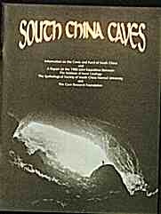
Rondal R. Bridgeman and Karen B. Lindsley. 1991. 25 b/w photos, 20 maps and illustrations. 62 pp. 81/2 x 11 South China Caves is a very informative and well-illustrated report on the March 1988, joint expedition of the Institute of Karst Geology, the Speleologi- cal Society of South China Normal University, and the Cave Research Founda- tion. This report focuses on the high karst plateau in northern Guangdong Prov- ince, the slope mountain karst within southern Hunan Province, and the mature tower karst area in Guangxi Province of southern China. These areas are rich in caves and have the potential to contain the deepest caves in the world. An overview of the geology of these areas is included along with chapters that cover speleothems, cave fauna, cave management and conservation, karst management, and the background of modern Chinese speleology. Readers will also enjoy Michael Ray Taylor's light-hearted excerpts from his surface diary of the people and places of this area.
By Herbert Daniel Gebauer. 430 p., countless maps and cave surveys; Berlin 2012. BHB publications 47 & 48. The "bible" on karst and caves of the East Khasi Hills and the Ri Bhoi district in Meghalaya/India. Alphabetical cave directory of far over 700 caves descriptions. Longest cave is Krem Mawkyhrdop (Mawmluh) at 7.2 km. An incredible source for future expe-ditions as many caves in the East Khasi Hills are still unsurveyed. Vol. 47 has 210 pages and contains the introduction, geological settings, thorough area descriptions as well as the 1st part of cave registry. Vol. 48 provides, on 220 pages, the 2nd part of the registry, cave lists, maps, and references. In English.